


A lost island, a sunken ship and a unique ingot discovered by archaeologists near Kamchia (see pics)
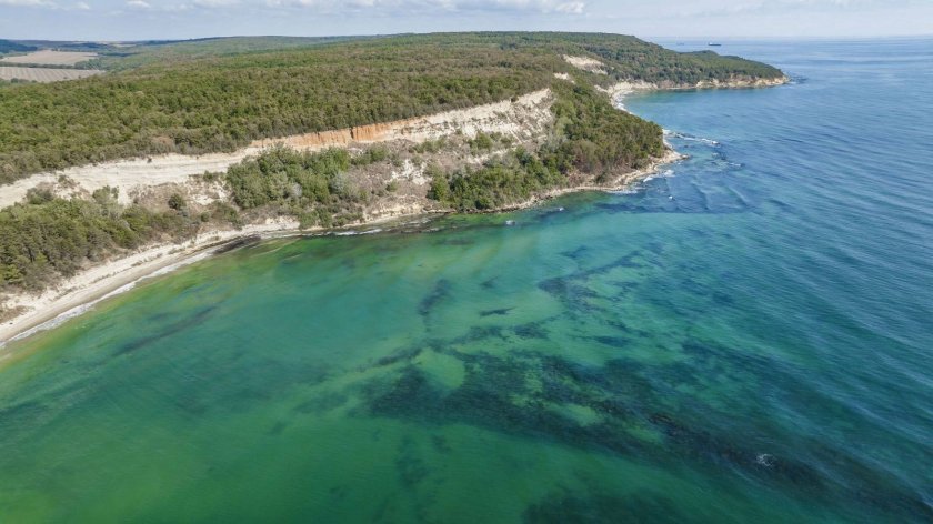
Archaeologists from the National Museum of History made sensational discoveries during underwater explorations near the mouth of the river Kamchia in the Black Sea. The diving team's most exciting discoveries include the remains of a sunken ship from the Ottoman period, a seemingly lost mysterious island and a unique lead ingot.
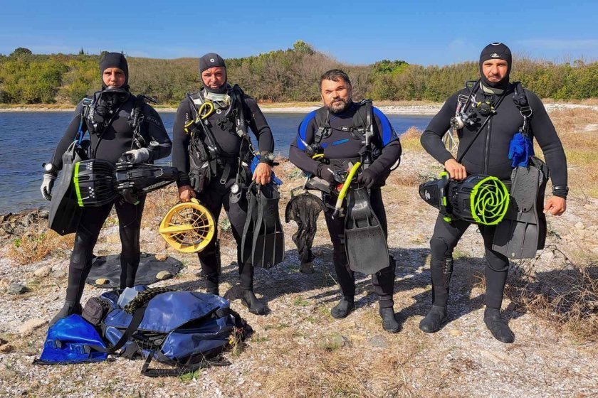
The underwater surveys were carried out in two phases - in September and November north of the mouth of the river Kamchia. The diving team was led by the Deputy Director of the National History Museum, Prof. Dr. Ivan Hristov.
The lead ingot
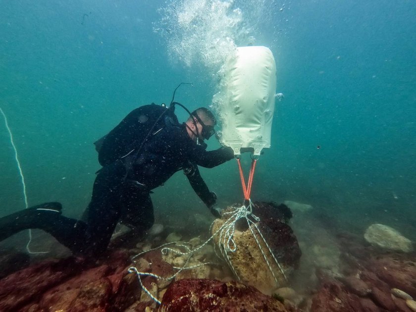
The diving team's first find was a lead ingot. Curiously, it had reached the waters of the Black Sea from Roman mines in the Cornwall area, according to the research leader.
There are parallels to ingots found in Roman Britain, and the object is dated to the 2-4th centuries. Historians remind us that Cornwall and Devon dominated the European market for tin only from late Roman times, starting around the 3rd century AD, as many Spanish tin mines were exhausted. Cornwall retained its importance as a source of tin throughout the medieval and modern periods.
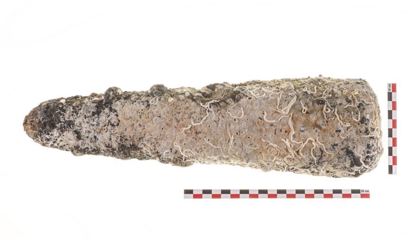
This is the first find in Bulgarian territorial waters of this nature. It weighs 5.35 kg and, according to laboratory tests carried out at the NHM, includes 98% pure tin.
The ingot from the Black Sea was prepared for delivery to a smithy on land for making bronze objects or coins.
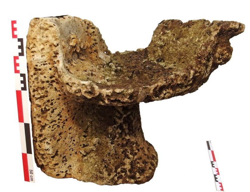
The stone tank for holy water
Another extremely rare object that has attracted the attention of archaeologists is a ritual vessel made of a stone called perirantherium (περιρραντήριον) by the ancient Greeks.
The perirantherium (περι + ῥαίνειν) was an ancient Greek vessel used in pagan cults as a reservoir for holy water. It was made of hewn stone, marble and less commonly baked clay. It has been found in various shrines.
 -
-
The object is the first of its kind to come up under water on our Black Sea coast. It is also extremely rare on land.
Whether the stone object falls near the mouth of the river. Kamchia from a shipwreck or was on the site within the boundaries of a seaside sanctuary remains a mystery. But it is no coincidence that divers discovered a half-stone sherd, deliberately cut as a shrine gift by travelling sailors.
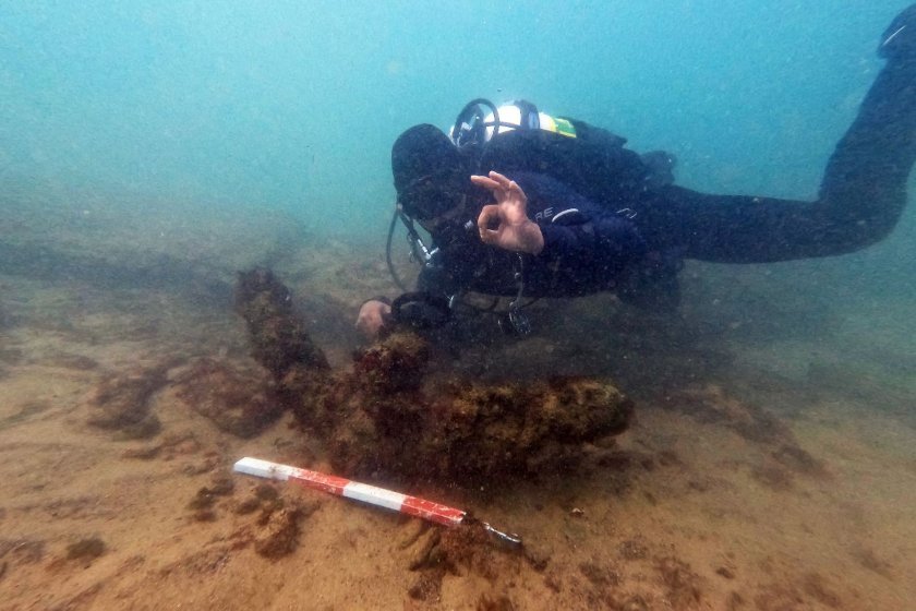
Underwater explorations have uncovered whole and fragmented amphorae as well as iron anchors from various historical periods.
The wreck
An important find was the location of the wreck of a sunken ship from the Ottoman period. A well-preserved wooden keel lies on the seabed. Divers recovered two cannons and fragments of pottery. The ship was probably sunk in bad weather, seeking protection in the small bay of Cape Ilanjik. It is presumed to have crashed on shallow jutting reefs, difficult to see in a storm.
The project involves not only underwater searches, but also geophysical surveys between the mouth of the river Kamchia and Cape Paletsa (thumb), led by Eng. Kiril Velkovski, associate of the Centre for Underwater Archaeology in Sozopol.
The disappeared island
Using side-scan sonar and a multibeam echo sounder, the boundaries of an apparently lost secretive island near the very mouth of the river Kamchia were located.
From the data obtained it can be concluded that the reef may have supported an island in the past, which most likely abraded. This island is marked on numerous Western European maps in the period 1452-1750.
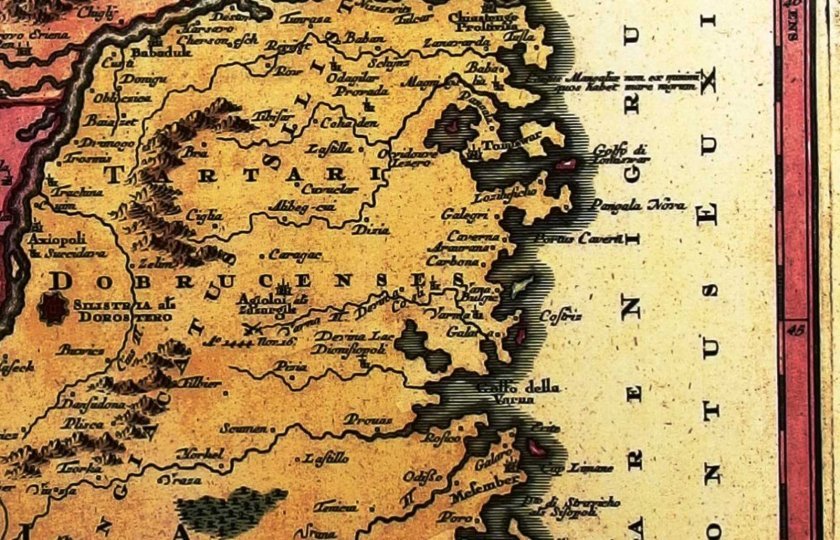
Many of the maps of this period show islands that do not exist today or are smaller in area than those mapped then.
Experts at the Institute of Oceanology in the city of Varna say that during the Middle Ages there was a decline in sea level. This is the Korsun Regression, named after the medieval city of Korsun (ant. Chersonese, present-day Sevastopol in Ukraine).
Obviously, during this period the coastline was different from the modern one, and it is quite expected that there were smaller or larger islands that were important for medieval navigators (places of shelter in strong winds, reef hazards, etc.). This is probably the case of the island in front of the Kamchia estuary, called by the local fishermen "Kamchia Stone". The island is a slightly elongated reef in the north-south direction, approximately 520 m wide and 870 m long.
The researches are part of the project 'Underwater archaeological investigations in the water area of the ancient roadside station Erite at the mouth of the river. Panysos (Kamchia)" with the financial support of the Ministry of Culture and the National History Museum.
Scientific advisors for the research are Dr. Dragomir Garbov (Federal Department of Climate Change, Environment, Energy and Water Camberra, Australia) and Assoc. Prof. Dr. Krum Bachvarov (University of Connecticut, Department of Anthropology). Todor Dimitrov - diver and NHM photographer, Eng. Totyo Anguelov - cartographer and geodesist, Tencho Tenev - Manager of Municipal Diving Center - town of Sozopol, Radostin Penev (Centre for Underwater Archaeology), professional divers and friends of the museum.
Experts from the National History Museum point out that the water area between Cherni Cape and Cape Galata at the city of Varna is among the least explored underwater areas of the northern Bulgarian Black Sea coast.
At the suggestion of the director of the CUA Dr. Naiden Prahov, targeted research in this water area has began.
Get the latest news wherever you are!
Follow us on
Facebook
and
Instagram
Follow BNT’s YouTube channel
You can now also watch us on
TikTok
Find us on
Google News
